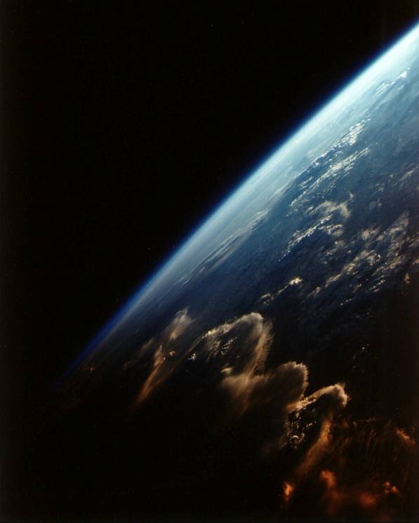
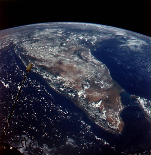
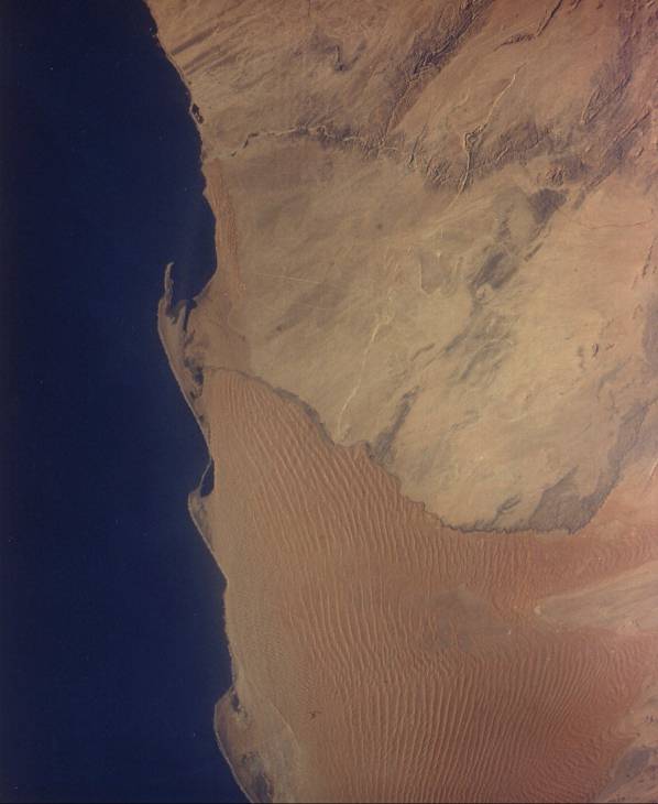
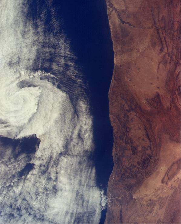
A striking photograph of asunset seen from space. The low elevation sun lights a cloud front withgold as Gemini VII looks southward down the Andes and the Altiplano of Bolivia, Chile, and Argentina. The sun is setting in the Argentine Chaco. Sunlight barely illuminates the large salt flats of Uyuni and Atacama. Gemini photography can be beautiful as well as scientifically informative. (S65-63780; Gemini VII.)From an altitude of approximately 700 kilometers, the Indian subcontinent passes by. The Island of Ceylon is to the right, the Bay of Bengal is to the upper right, and the Arabian Sea is to the left. A narrow band of tropical rain forests stretches along the west coast of India from Cape Comorin northward, permitting one to easily differentiate rain forests from deserts and savannas. The thin band of offshore clouds running from Bombay around India into the Bay of Bengal gives new clues to India’s climate. (S66-54676; Gemini XI.)The navigators and explorers of 500 years ago had a great fear of sailing along the hostile Atlantic coasts of Africa. Such fears hastened the discovery and European occupation of the Americas. This view clearly shows 400 kilometers of"Skeleton Coast" of Southwest Africa. Constant northerly winds cause the development of parallel sand dunes which, in some cases, are over 200 kilometers long and over 300 meters high. Seifs, as they are called, are rarely found and parallel the wind direction; most dunes are transverse to the wind direction. A combination of wind-blown sand from the Namib Desert and the strong northward Benguela Current cause the development of sand hooks or capes. This dry and hostile area with an equally hostile name receives about 100 centimeters of rain a century. (S65-45579; Gemini V.)A strange circular featureabout 40 kilometers in diameter and about 300 meters deep is seen in the Sahara of Mauritania. It is called Richat. It was first believed to be caused by a meteor impact, but later geological studies and the fact that it is seen in a single space photograph indicate that it is aunique wind erosional feature caused by the abrasive forces of swirling sand. (S65-34670; Gemini IV.)Topographic features cangreatly influence the weather and the development of weather systems. A classic vortex about 50 kilometers in diameter is clearly seen off the coast of Morocco. In this case, wind shear at Ras (Cape) Rhir, a coastal promontory, caused the wind to develop its circular motion. Such phenomena can be clearly studied from the unique vantage point of space, increasing our knowledge of weather systems and their possible future control. Weather satellites have provided the information which has saved hundreds of thousands of lives in the United States and elsewhere. (S65-45665; Gemini V.)