Chapter 7: Unusual Features (1/2)
![Figure 222. - Location of photographs in this chapter; numbers correspond to figure numbers. [Base map courtesy of the National Geographic Society.]](./images/p210a.jpg)
![Figure 222. - Location of photographs in this chapter; numbers correspond to figure numbers. [Base map courtesy of the National Geographic Society.]](./images/p210b.jpg)
Figure 222. - Location of photographs in this chapter; numbers correspond to figure numbers. [Base map courtesy of the National Geographic Society.]
Included in this chapter is a pot pourri of features that defy easy classification. Many craters with unusual shapes are represented that may be volcanic rather than impact in origin. Other craters have irregular hummocky deposits on their floors; still others may be covered by lava flows. Other features depict collapsed lava tubes or depressions formed by drainage of fragmental surface material into cracks. Together they constitute a fascinating group of features, and they are grouped in this chapter because, at the resolution of the Apollo imagery, more than the usual uncertainty exists in attempting to interpret their origin. Perhaps later Moon landings or a comparison of these pictures with orbiter photography of Earth, Mars, and other planetary bodies will provide additional insight into the geologic processes that formed them. - H.M.
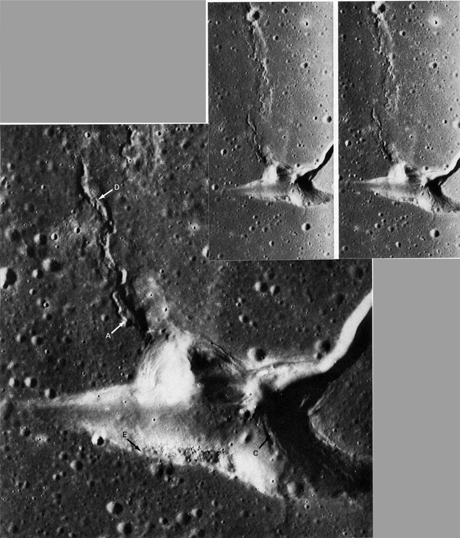
FIGURE 223. - Although this is a rather bizarre example, sharp, deep, spearhead-shaped depressions form the heads of many lunar rilles. The best-known example is the depression at the head of Rima Hadley near the Apollo 15 landing site. They probably develop by collapse into voids left by lava tubes and shallow magma chambers. This is Aratus CA in western Mare Serenitatis. The branch heading northeastward to the right edge of the stereogram, which terminates a few hundred meters beyond the picture, is the rille-a very short one. The fresh-appearing wrinkle or mare ridge that crosses a small (300 m) young crater at A (see enlargement) may postdate the spearhead depression as its extension appears to protrude along the wall at B and the floor at C. It is part of an older, broader, more subdued ridge that has been disrupted by the collapse depression. Incipient collapse along the younger ridge is visible at D. Note how the mare surface truncates a resistant layer (presumably a basalt flow) in the wall of the depression at E. This suggests either the tilting of older mare basalts eastward prior to the latest extrusion of basalt or, more likely, that the resistant layer is lenticular. - D.H.S.
AS15-9299 (P)
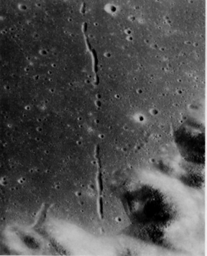
FIGURE 224. - On January 16, 1973, the Soviet unmanned roving vehicle Lunokhod 2 was landed by Luna 21 in or near this area in the southeastern part of the crater Le Monnier. This crater is a large (61 -km) pre-Imbrian crater cut into terra at the eastern edge of Mare Serenitatis before Serenitatis was flooded by mare laves. Part of Le Monnier's southern wall fills the lower part of the picture. A conspicuous chain of elongate depressions has formed in the lava-filled floor of the crater. The chain trends 22 km northward and its pattern is quite surely controlled by an underlying fracture system. Regionally, the inferred fracture system is concentric to the grossly circular Serenitatis basin, and in this area trends northward. No comparably young structural features having the same trend cut the terrae surrounding Le Monnier. However, older structures having this trend occur in the southern and northern walls and rims of Le Monnier. The alined depressions on the mare are mostly 300 to 400 m wide and 30 to 60 m deep. The three deepest stretches are 1 to 2 km long and about 50 to 65 m deep. These depressions probably were the locus of fissure eruptions of mare basalt. Withdrawal of the last lava back into the fissure may have created subsurface voids into which collapse took place, causing the depressions and accounting for the absence of raised rims on the depressions. - R.E.E.
AS15-0244 (P)
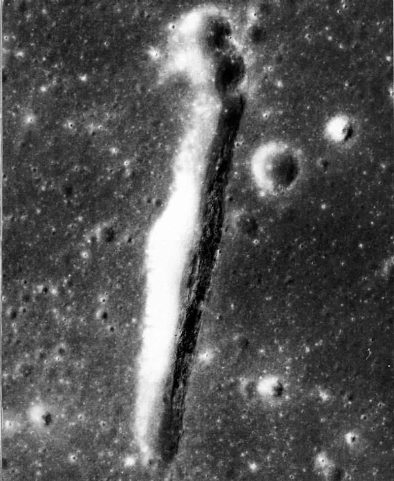
FIGURE 225. - Although considerably wider and longer than the largest of the depressions described in figure 224, this one otherwise closely resembles them. It probably formed in the same way; that is, by collapse into a fissurelike cavity caused by the withdrawal of mare basalt. Closer viewing (and greater enlargement of the original frame) clearly reveals signs of mass wasting. Note the incipient slump fractures along the right rim and large fragments along the right wall and in the bottom of the depression. - G.W.C.
AS15-9361 (P)
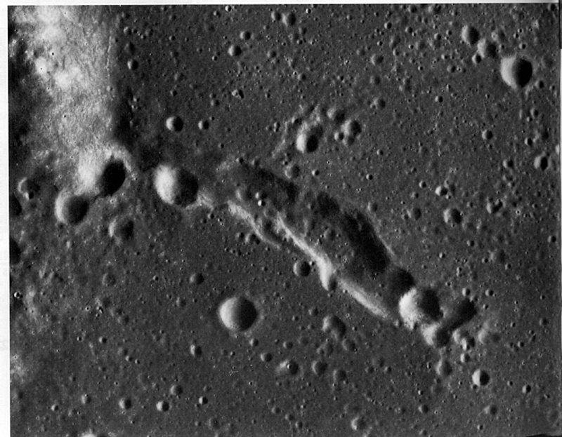
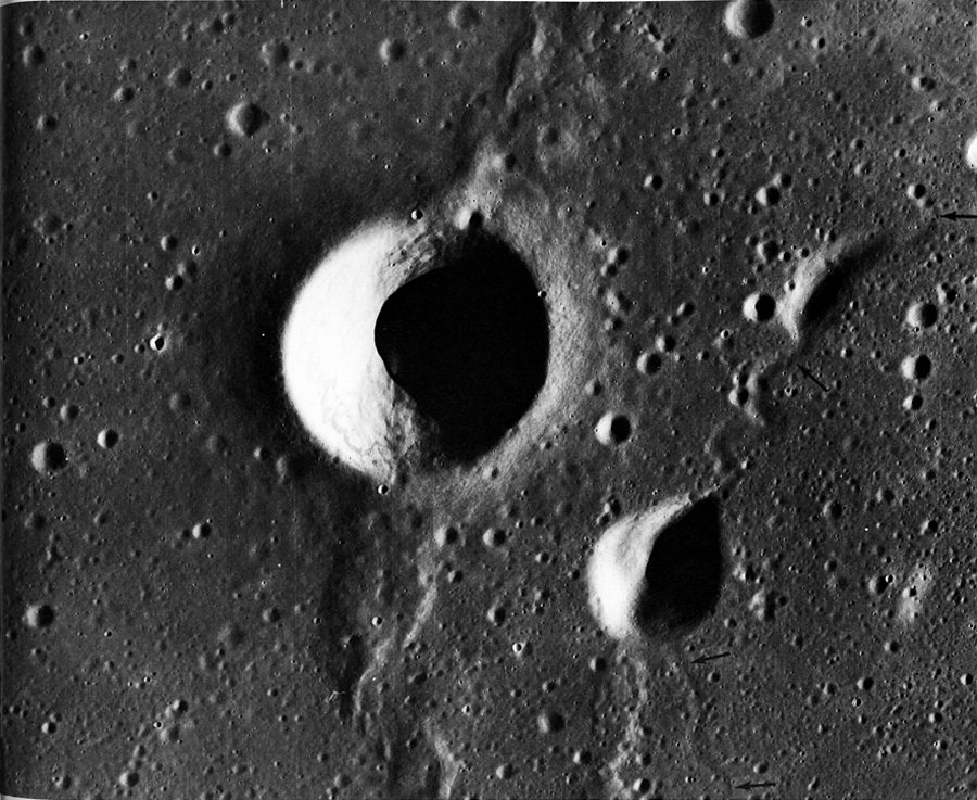
FIGURE 226. - Low-rimmed or rimless depressions having irregular outlines are not uncommon on mare surfaces. The one pictured, near the western margin of Mare Serenitatis, is about 10 km long and appears to have been formed by collapse and the coalescence of small craters. - D.H.S.
AS15-9361 (P)
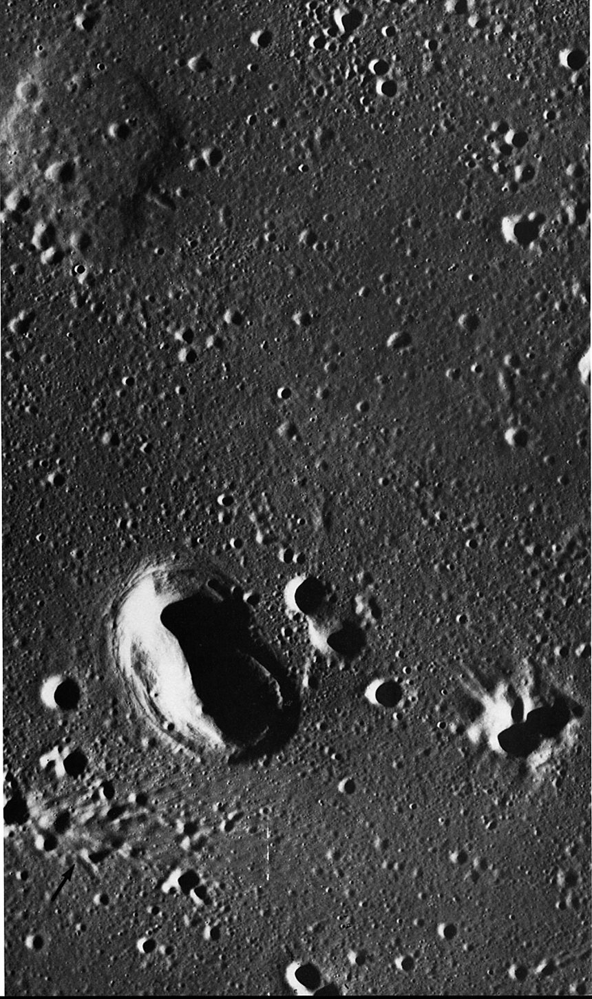
FIGURE 227. - The largest crater in this picture is Aratus D in western Mare Serenitatis. Its circular outline, high rim, and deep bowl-shaped interior are characteristic of many impact craters of comparable size and age. The next largest crater is tear shaped and nearly rimless. It is, furthermore, associated with a rille (arrows). These differences strongly suggest that it was formed or at least highly modified by structural collapse. - D.H.S.
AS17-3125 (P)
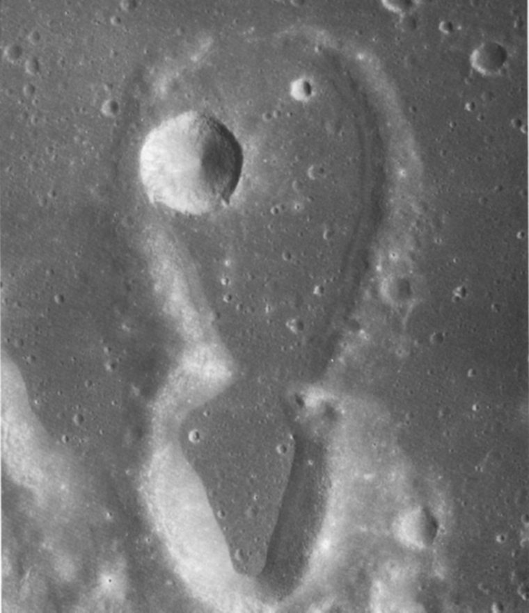
FIGURE 228. - The very young rimless crater near the center of this picture is located near the area where Oceanus Procellarum and Mare Imbrium join. The crater apparently formed in regolith-covered mare basalt. It differs from lunar impact craters of comparable size and age by its lack of a raised rim, surrounding ejecta deposit, or associated secondary impact craters. In addition, its interior walls do not show the steep slopes with craggy outcrops of rock in their upper parts, nor the streams of debris-avalanche deposits and talus that are usually seen in the walls of impact craters of comparable age and size.
Judging from the clear and sharply formed pattern of concentrically curved grooves and scarps that surround the hole, the material near this depression has apparently subsided into a subsurface void. Because of the extreme rarity and inferred short lifetime of steep slopes on the Moon, the latest subsidence must have taken place very recently, after most of the 50- to 300- m diameter craters that densely pepper the nearby mare surface were formed. Movement of the regolithic debris layer during subsidence apparently smoothed out most, if not all, of the craters that must have existed near the depression. Now the depression is surrounded by low, curved fault scarps and narrow, curved grooves that may be fault troughs (grabens) or may represent drainage of regolithic debris into cracks that opened in the underlying sagging basalt rock. The few craters that have formed on the subsided surface compare in density to the craters formed on the cluster (arrow) of Aristarchus secondary impact craters and associated herring- bone ridges; comparable ages for the Aristarchus secondary features and the depression are thus indicated. The subsidence was triggered either by the ground shock or seismic wavetrain generated when Aristarchus was formed 300 km to the west, or by the impacts of the secondary features.
The subdued depression in the upper left may be a similar older feature that was flooded by a later lava flow that now covers the area. The density of craters within the depression and the density on the surrounding lava are comparable. Alternatively, the subsidence there may have been incomplete; however, there is no sign that this subsidence is as young as that in the deeper crater. - R.E.E.
AS16-5410 (P)
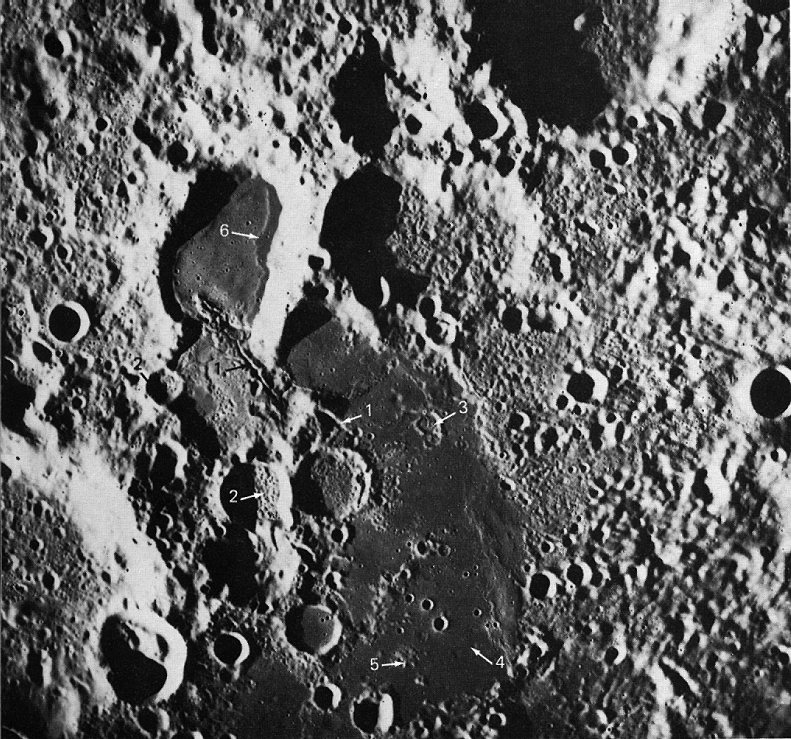
FIGURE 229. - This 18-km-long ''figure 8" pair of noncircular craters near the crater Guericke probably was not formed by hypervelocity impacts of bodies from space. It could be a secondary impact feature formed by projectiles from the Imbrium basin 700 km to the north. The terrace at the base of the crater walls could be debris from the walls or a "bathtub ring" left by a formerly higher stand of the mare fill. Alternatively, the crater pair and the terrace could have been formed by volcanic eruptions. The superposed bright crater is younger than and unrelated to either the "figure 8" pair or the mare. - D.E.W.
AS15-2627 (M)
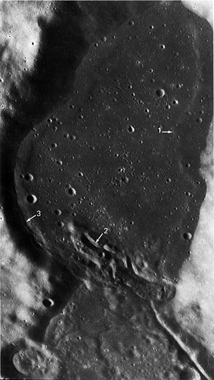
FIGURE 230. - This area of mare material in the farside uplands centered at 26°S, 103°E shows many features. There are fractures (arrows 1) that may have been vents from which much of the smooth, dark lava was extruded; some of these fractures are bounded by lava levees. Craters containing bulbous material (arrows 2) that may be lavas extruded through the brecciated crater floor are visible. There are breached and partly flooded craters (arrow 3) and barely discernible flooded craters (arrow 4). Mantled remnants of uplands (arrow 5) are still visible. Terraces (arrow 6) mark the level of lava prior to subsidence in the center of the depression. - M.W.
AS15-9960 (P)
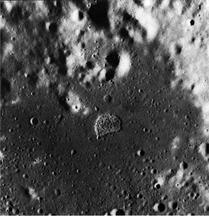
FIGURE 231. - In this part of the area of figure 230, the terrace (arrow 1) is shown again. Other features shown here are a fracture with lava levees (arrow 2), a "strand line" (arrow 3) marking the level of lava before cooling and withdrawal, and a scarp of a fresh-appearing lava flow front (arrow 4). - M.W.
AS17-1672 (M)
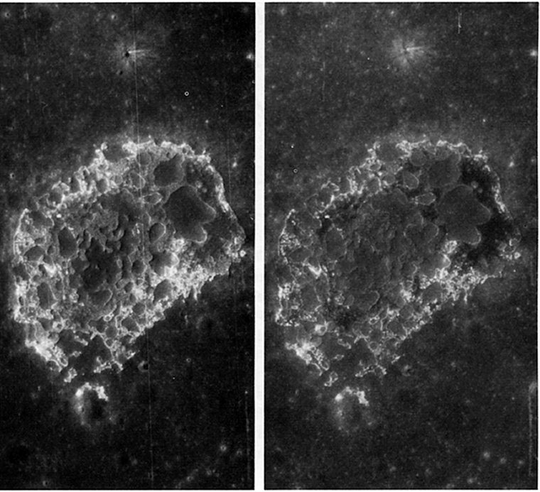
FIGURE 232. - The steep-walled but shallow D-shaped depression near the center of the photograph is apparently a unique feature. It is located in a patch of mare on the foothills of the Montes Haemus, west of Mare Serenitatis. Measured along its straight side, the depression is about 3 km wide. It is situated atop a very gentle circular dome that appears to be somewhat smoother than the surrounding mare surface. As is more clearly shown in the accompanying stereogram (fig. 233), the many bulbous structures on the floor give it a blisterlike appearance.
The depression is believed to be volcanic, probably a caldera (El-Baz, 1973b). Figure 234 explains the probable sequence of events leading to the formation of this unusual structure. - F.E.- B.
AS15-9960 (P)
FIGURE 233. - The enlarged view provided by this stereogram shows that there are at least three different types of material within the floor of the D-shaped depression. A brighter annulus parallels the wall, and darker material fills the inner floor. Within both areas numerous bulbous and slightly raised comical structures are easily distinguishable. There are craters on the summits of many of the structures, suggesting that each one is probably an extrusive dome with a summit crater. Many similar features on Earth are caused by the subterranean drainage of lavas following extrusion and release of pressure following the upward movement of a central plug. - F.E.- B.
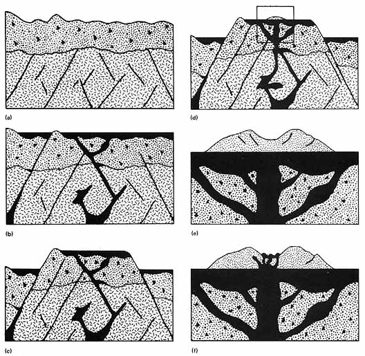
FIGURE 234. - This diagram shows a postulated sequence of events leading to the formation of the D-shaped structure; the events are presented in order of occurrence: (a) Numerous faults were generated in the crust and a thick blanket of debris was deposited (upper layer) as a result of the gigantic impact event that formed the Imbrium basin. (b) Basaltic lavas migrated to the surface along fractures to form a small, probably thin layer of mare material. Higher areas escaped inundation. (c) Vertical displacement then occurred along major faults, and the inundated block was displaced upward relative to the surrounding blocks. (d) A broad, gentle volcanic dome formed. It is recognizable as a younger eruptive stage because its surface is less densely cratered than the surrounding mare surface. (e) The center of the dome collapsed to form the caldera. This segment is outlined in (d). (f) Many small extrusions of lava formed the bulbous structures on the caldera floor. The centers of some of these later collapsed to form small summit craters, thus, on a much smaller scale, repeating the earlier collapse caldera sequence. - F.E.- B.
AS15-9358 (P)
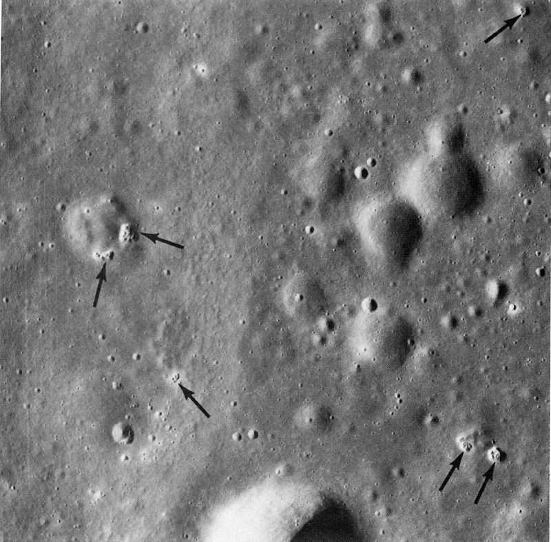
FIGURE 235. - Several extraordinary, tiny, puckered, collapse depressions (arrows) are in this detailed view of a very small area of western Mare Serenitatis. The collapse depressions are distinctly different from the many normal craters in this picture. One normal crater contains two clusters of the depressions. Such depressions are known nowhere else on the Moon; their closest analog is the odd but very much larger feature shown in figures 232 and 233. The collapse depressions here are much fresher and younger than the cratered lavas in which they occur. In fact, they must be among the youngest nonimpact features on the Moon. How the collapses occurred is an intriguing puzzle. Were they formed by the recent escape of gas from beneath the surface? - K.A.H.
AS17-1931 (P)
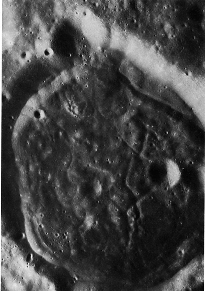
FIGURE 236. - A panoramic camera view of an unusual crater on the lunar far side, west of the large crater Aitken. The crater is polygonal in outline, its rim is not raised, and its walls are relatively smooth. The floor of the crater is occupied by a rather dark material with numerous cracks. This pattern has been informally referred to as a turtleback crater floor (El-Baz and Roosa, 1972). It occurs only in a few craters on the lunar surface and is probably caused by the cooling of a molten or partially molten fill within the crater. However, cracking due to tectonic movement (for example, the upward thrust of a central plug) cannot be excluded. - F.E.- B.
AS16-4151 (P)
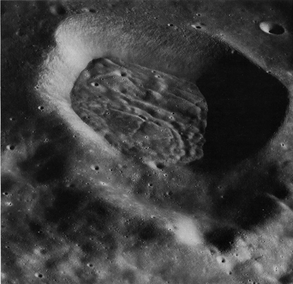
FIGURE 237. - A view looking south into a small 19-km diameter crater southwest of Mandel'shtam on the lunar far side. The crater has a floor that is heavily lineated and grooved, but this structure is subdued rather than sharp and is contained wholly within the crater. The cracked floor is typical of a variety of craters that occur in the highlands away from the mare basins. They differ from cracked floor craters, such as Humboldt, and rilled craters, such as Goclenius; their origin is unknown. - J.W.H.
AS15-8893 (P)
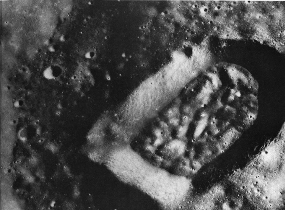
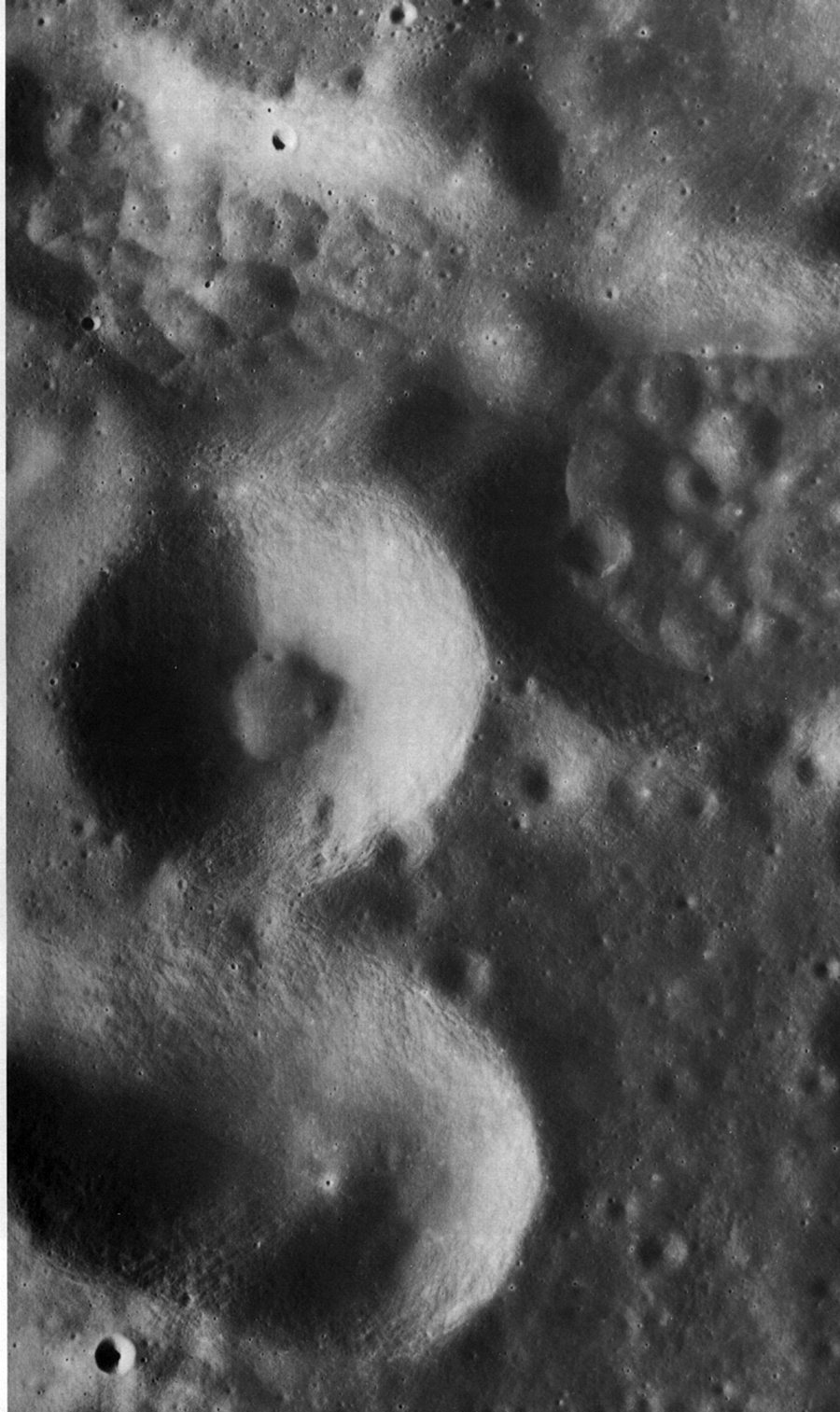
FIGURE 238. - The obvious peculiarity of this crater is its shape, the causes for which are open to speculation. The entire area pictured is in the floor of the 60-km-diameter crater Barbier, located on the lunar far side and centered at 23.9° S, 157.7° E. Barbier is a relatively old crater, and the high density of craters on its floor is evident in this high-resolution photograph from the Apollo 15 panoramic camera. The two angular corners of the oddly shaped crater suggest that its present form is partly controlled by faults or joints in the floor of Barbier. The slightly raised rim of the crater evidenced in the shadow on the rim at the left and the brightening on the rim in the lower right side of the crater-shows that material was ejected from the crater at the time of its formation and that it is not simply a collapsed portion of the floor of Barbier. The long dimension of the pictured crater is 16 km, and the short dimension is 10 km. - M.C.M.
AS15-8910 (P)
FIGURE 239. - The four large depressions in this photograph are part of a cluster of secondary impact craters on the floor of Gagarin, a large (275-km-diameter) crater on the far side of the Moon. The secondaries pictured here lie close to Gagarin's northeastern rim. Mapped as pre-Nectarian in age (Stuart-Alexander, 1976), Gagarin is filled with relatively bright plains-forming deposits. The plains deposits are probably about I km thick; Gagarin was originally about 4 to 5 km deep.
Of particular interest in this photograph are the peculiar bumpy floors of the two craters nearest the upper right corner of the photograph. Several other craters in this part of Gagarin have the same morphology. The rounded hills or bumps, I/z to 2 km across, fill the crater floors so that the craters are shallower than is normal for craters of their size and age. For example, the center crater of the four is now the deepest, yet the two eastern ones are as wide or wider and, therefore, should be at least as deep.
A possible explanation for both the surface morphology and the raised floor level of the two eastern craters may be related to the intrusion of magma into the brecciated materials that probably occurred on the floors of these craters. It is known that the bottoms of freshly formed impact craters of this size often contain a deposit of low- density fragmental material. Even though areas of mare material are quite limited on the far side of the Moon, it is reasonable to assume that mare-basalt magma underlies the subsurface in this section of the floor of Gagarin. Mare lava, for example, is exposed in the floor of a larger (90-km-diameter) crater on the west rim of Gagarin. (See fig. 240.) The fracture system associated with the inner walls of a large crater is a likely conduit along which magma may rise and then intrude into the weakest strata. Because the floors of impact craters consist of low-density fragmental material, any crater on the floor of Gagarin, situated near its walls, may have served as a locus for magmatic intrusion. As lunar mare magma rose through the subsurface from a zone of melting at depth and reached the debris in the two crater floors, it may have lifted the debris and fractured it into segments l/2 to 2 km across. Surficial fragmental debris from the uplifted segments then drained into the cracks between them to produce the bumpy, rounded topography. The low-density segments would tend to "float" at the same general level on the underlying denser magma, with the largest segments standing highest. The relative amount of uplift of materials in the craters in this photograph correlates both with the original depth of the craters (inferred from their diameters, which are proportional to depth) and with their proximity to the wall of Gagarin, which is located about 1 1/2 km inside the northeastern corner of the picture. Correlation with crater depth suggests that the magma intruded under the deepest crater because the roof was thinnest there and offered the least resistance. Correlation with proximity to Gagarin's wall indicates that the inferred fracture zone near the wall provided a locus for easier subsurface flow and better subsurface plumbing for the upwelling magma. The bumpy material in the northwest depression stands highest of all. Although it was neither the deepest nor the nearest to Gagarin's wall, it may have been centered over the contact between Gagarin's original floor material and the wall and thus been a locus for intrusion. Subsurface flow from the largest (northeastern) depression into the northwestern one may have contributed to uplift of the latter depression; the hill forming the septum between them is the largest uplifted block in the cluster and indicates that intrusion took place under the septum. - R.E.
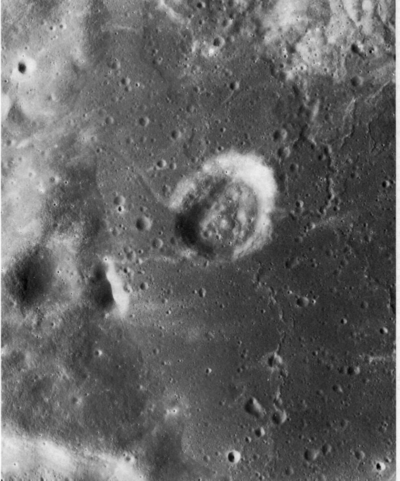
FIGURE 240. - This photograph shows part of the floor and walls of the largest (90 km) crater inside the old pre-lmbrian crater Gagarin on the far side of the Moon. The 90-km crater is partly filled with relatively dark, young mare materials and contains the circular depression shown here. The depression is about 4 km in diameter and has a very low raised rim or none at all. Rock layering and narrow terraces along resistant layers are visible. The floor of the depression and the adjacent mare surfaces have an equal density of craters, suggesting that they are the same age.
Morphological evidence supports the hypothesis that the depression was formed by collapse of the mare materials. Two narrow and shallow rilles debouch high on the west and east depression walls; they are interpreted as lava tubes that originated under the depression before it collapsed. This interpretation is further supported by the mare ridge, which extends down the south wall onto the depression floor. A dome adjacent to the ridge on the floor may also record late volcanic activity in the depression. - M.J.G.
AS15-8928 (P)
AS17-2334 (P)
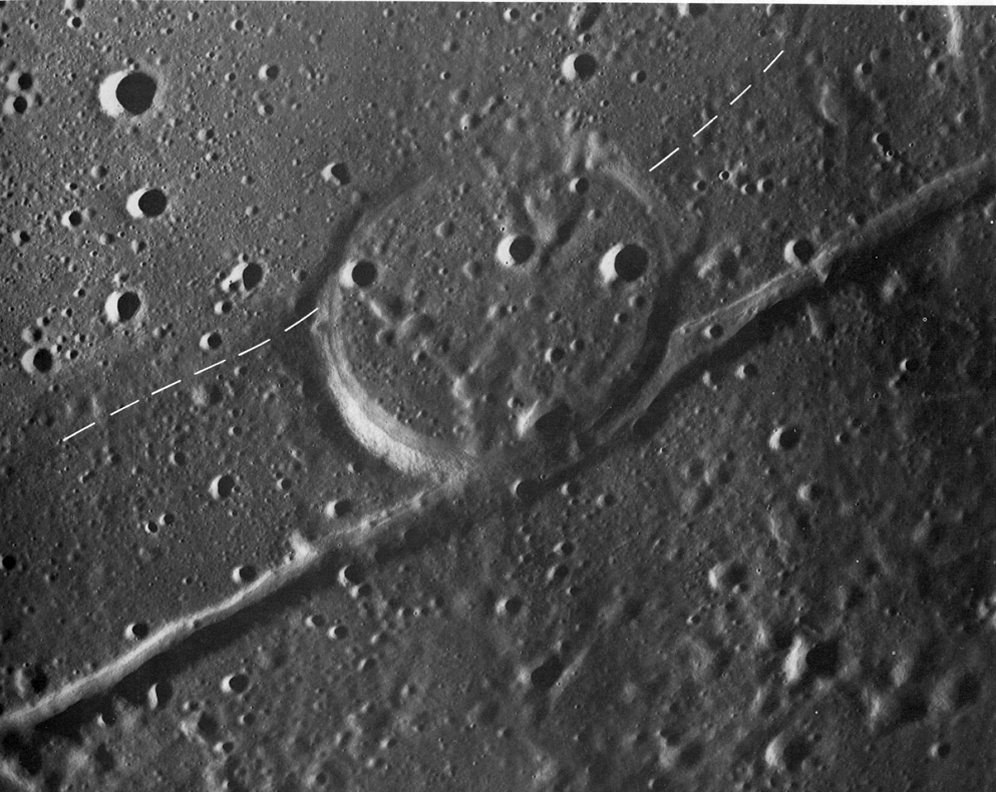
FIGURE 241. - This crater (approximately 9 km across) is on the juncture between two basalt units at the south border of Mare Serenitatis. The unit south of the dashed line forms a conspicuous dark border around the mare and slopes northward toward the center of the Serenitatis basin. The adjacent mare unit is lighter in color, generally flat, and embays the older dark unit. The straight rille grazing the crater is one of several concentric grabens in the dark border material and probably formed by extension as the lava sagged toward the basin center prior to emplacement of the central mare. The crater is largely filled by the younger mare unit; because the graben transects the crater rim and its trend is influenced by the crater, the graben is probably younger. - C.A.H.
AS17-2335 (P)
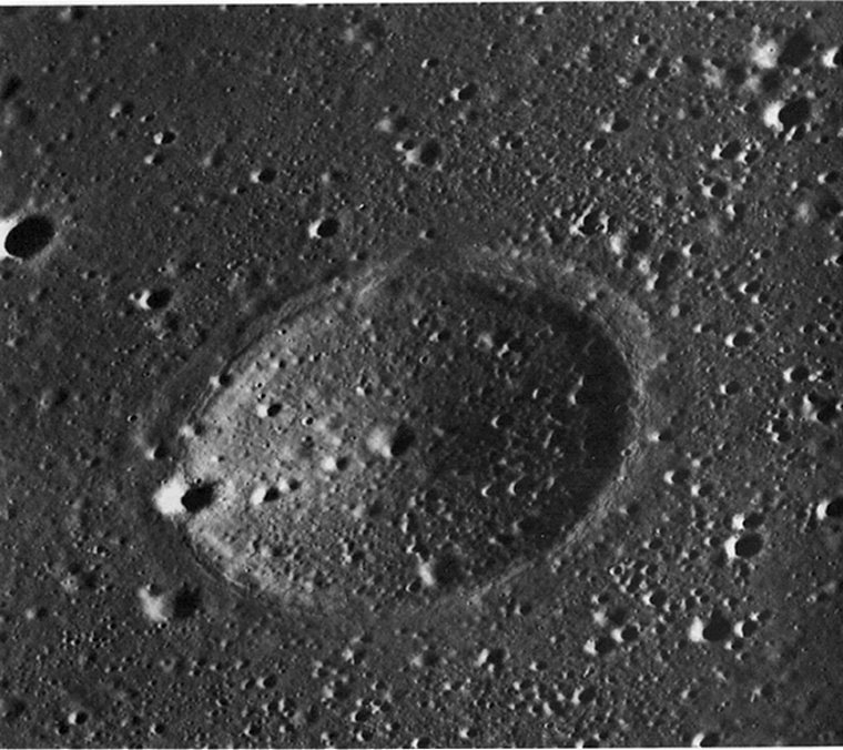
FIGURE 242. - This picture, showing an area in central Mare Serenitatis 200 km from the nearest outcrops of terra rocks, is an oblique view of a 4-km diameter crater form about 200 m deep. The crater floor is similar to the surface of the surrounding mare, which is presumably mare basalt covered by 3 to 6 m of regolith. The rim of the crater is raised, although subdued; from this we infer that the present form was developed when mare lava flooded a normal impact crater that had formed on a lower, preexisting surface. The flooding basalt then subsided, more or less in proportion to its thickness, which was greatest inside the crater. The subsidence may have resulted from escape of bubbles from the lava while it was soft, thermal contraction of the lava, and compaction of an underlying relatively loosely packed regolith. Regolith compaction may have occurred when the load and heat of the flooding lava crushed irregular fragments of regolith into more compact shapes and plastically deformed the glassy components of the regolith into more compact shapes or into voids between other particles.
R. J. Pike's (1972) data on the rim heights of lunar craters 90 m to 10 km in diameter indicate this crater probably had a rim about 200 m high when it was buried. The lava plain around the depression presently stands about 25 m below the rim crest, giving a minimum thickness for the flooding lava of 175 m. - R.E.E.
AS17-3067 (P)
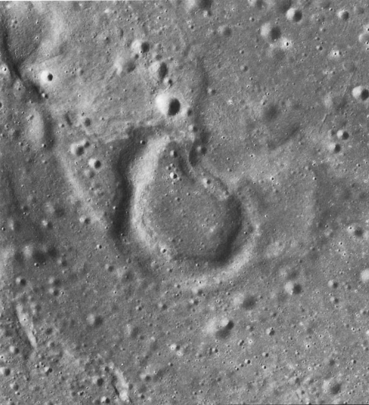
FIGURE 243. - This rimmed depression draped by mare lava is at the end of a mare ridge segment due north of Copernicus in Mare Imbrium. The unusual shape of the crater may indicate a volcanic origin; alternatively, a circular or elliptical impact crater may have been deformed by subsequent development of the mare ridge, a part of which impinges on the crater at the northeast side. In any case, a preexisting rimmed depression seems to have been buried by mare, reappearing as a mantled structure upon solidification and compaction of the lava. - C.A.H.
AS17-2318 (P)
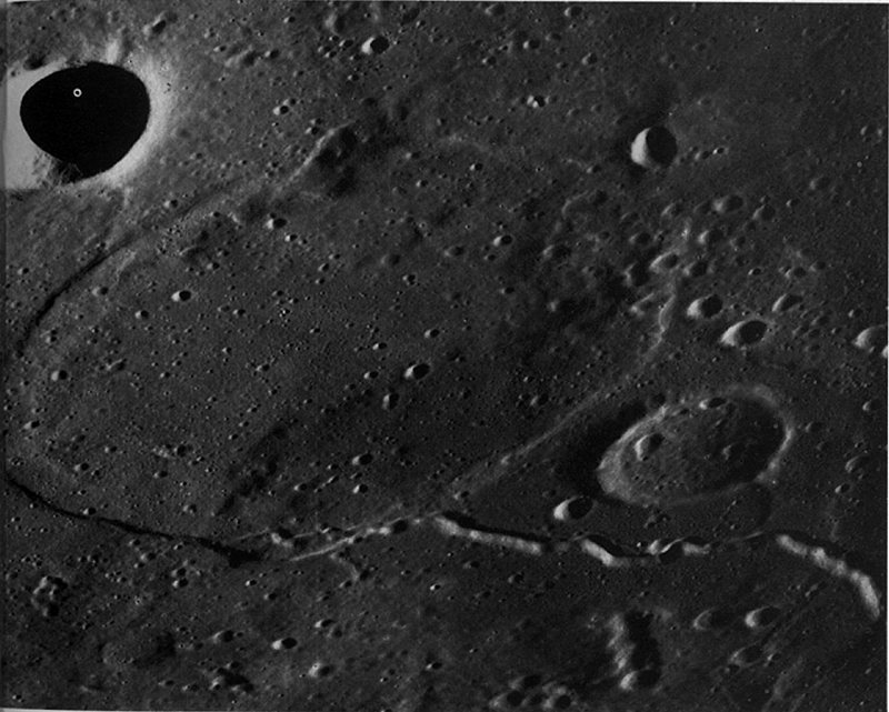
FIGURE 244. - This oblique photograph shows the buried crater Jansen R in northern Mare Tranquillitatis. This crater is about 25 km across, and empirical relationships between crater diameter and crater depth indicate that the mare basalt cover may be several kilometers thick. The rille in the right foreground may have been formed by the collapse of a lava tube. - D.H.S.
AS16-4525 (P)
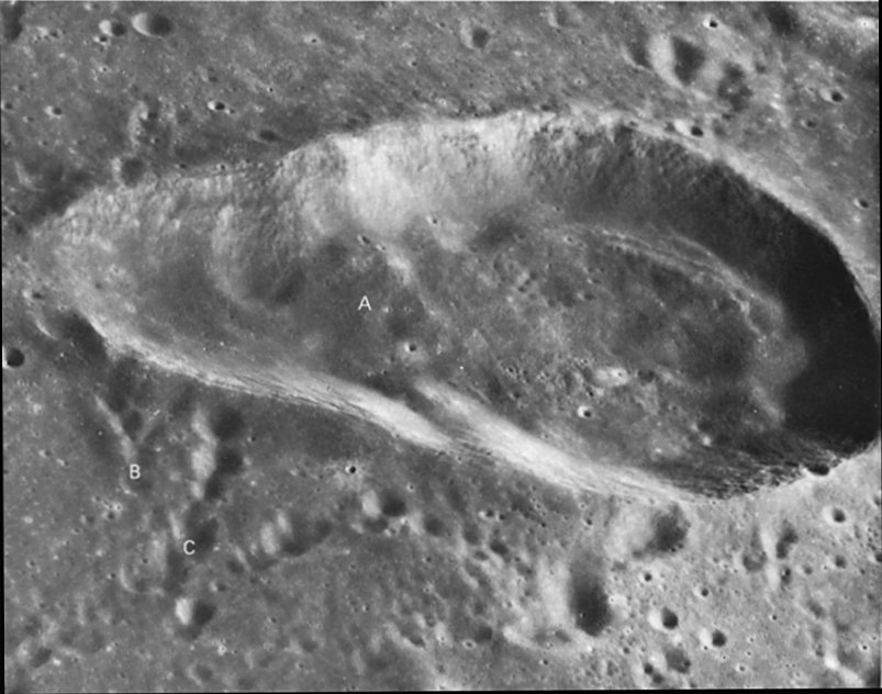
FIGURE 245. - The elongate crater Torricelli near the north margin of Mare Nectaris was probably formed by two simultaneous impacts as indicated by the partly developed septum at A. The overlapping clusters of small craters at B, C, and elsewhere around the rim were made by secondary impacts of ejecta from the large crater Theophilus more than 150 km to the southwest. - D.H.S.
AS16-5429 (P)
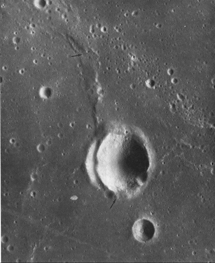
FIGURE 246. - This small unnamed crater in Mare Cognitum is unusual because it appears to be deformed by a fault that also bounds a mare ridge. About 5 km in diameter, the crater is obviously older than the mare materials that have buried the outer part of its ejecta blanket. The visible part of the fault extends between the arrows and clearly transects the western wall of the crater. It also marks the west flank of a small mare ridge north of the crater. Viewed stereoscopically, the fault plane can be seen to dip gently to the west, and the surface west of the fault is lower than that on the east. The fault is, therefore, a low-angle normal fault. The abrupt disappearance of the fault at the south rim of the crater may seem surprising. One of several explanations is that it may lie buried beneath a younger basalt flow that flooded the area immediately south of the crater. Many lunar investigators, including several contributors to this volume, have suggested a relationship between faulting and the development of mare ridges. Although this is a very small and certainly uncommon example, it is a convincing example of a mare ridge that is coincident with a fault and thus lends support to this idea. - G.W.C.
AS16-5587 (P)
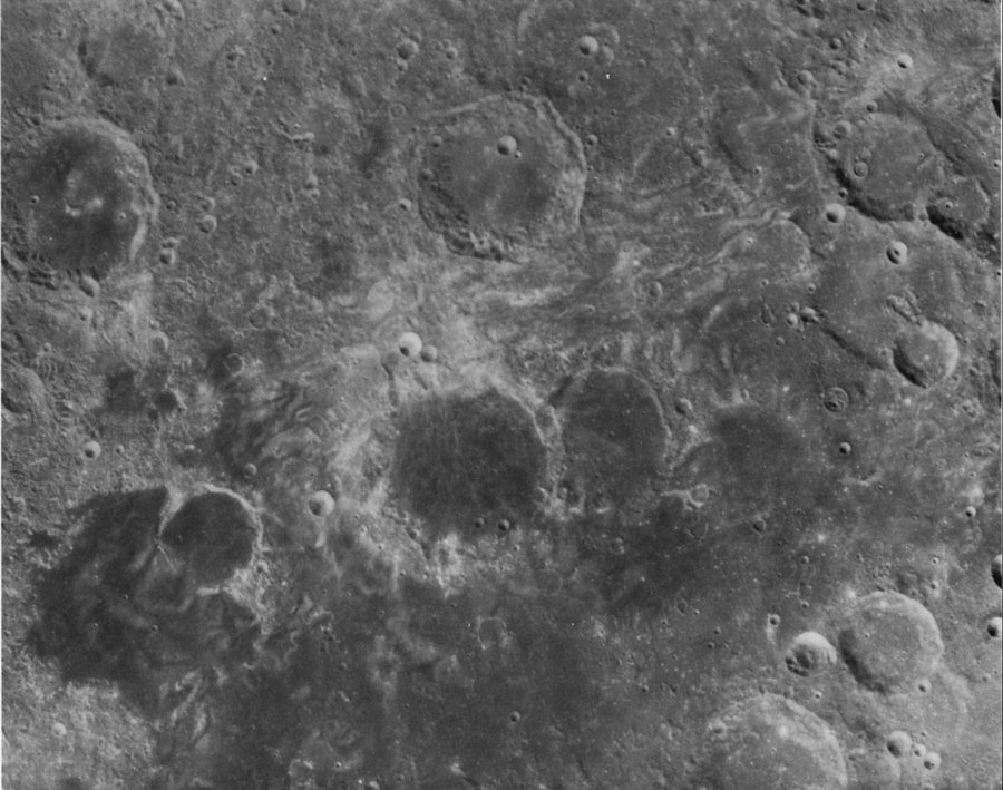
FIGURE 247. - Bright swirls in and around Mare Marginis on the eastern limb of the Moon. These peculiar markings that are characterized by very high albedo and sinuous outlines are not fully understood. In this particular field (El-Baz, 1972a) the swirls occur in all types of geomorphologic units: They abound in the dark and flat material of Mare Marginis, but they occur also in highland units. A good example of this occurrence is to the southeast of the crater Al-Biruni, upper middle of the photograph. The small fresh crater on the rim of Goddard (center of photograph) cannot be the cause of these swirls that extend far beyond the area shown.
This author previously indicated that the area is antipodal to the location of the Orientale basin on the west limb of the Moon. It is probable that the formation of the Orientale basin is responsible for these bright swirls-either by the meeting of fine ejecta at the antipodal point or by surface disturbance due to seismic waves traveling at or near the surface also meeting on the opposite side of the impact point. The origin of these swirls, however, is still open to discussion. - F.E.- B.
Alternate explanations for the swirls are based on the observations that they have no relief of their own and the crater density within the swirls is similar to surrounding areas. They may represent surface alteration products formed by gases that have escaped from the lunar interior or by some poorly understood process of ejecta deposition. Interaction with the extralunar environment may also have played a part in the development of the swirls. - J.W.H.