Scouting the Moon
By EDGAR M. CORTRIGHT
After centuries of studying the Moon and its motions, most astronomers faced with diminishing returns - had abandoned it to lovers and poets by the time that Sputnik ushered in the space age. The hardy few who had not been wooed away to greener astronomical pastures were soon to be richly rewarded for their patience.
Before the invention of the telescope in 1608, astronomers had to be content with two good eyes and a fertile imagination to surmise the nature of the lunar surface. As a consequence they mainly devoted themselves to the mathematics of the Moon’s motions relative to the Earth and Sun. The early telescopes that first revealed the crater-pocked face of the Moon touched off several centuries of speculation about the lunar surface by scientists and fiction writers alike - it often being unclear who was writing the fiction. But telescopes peering through the turbulent atmosphere of Earth have severe limitations. By 1956 the very best terrestrial telescope images of the Moon were only able to resolve objects about the size of the U.S. Capitol. Anything smaller was a mystery.
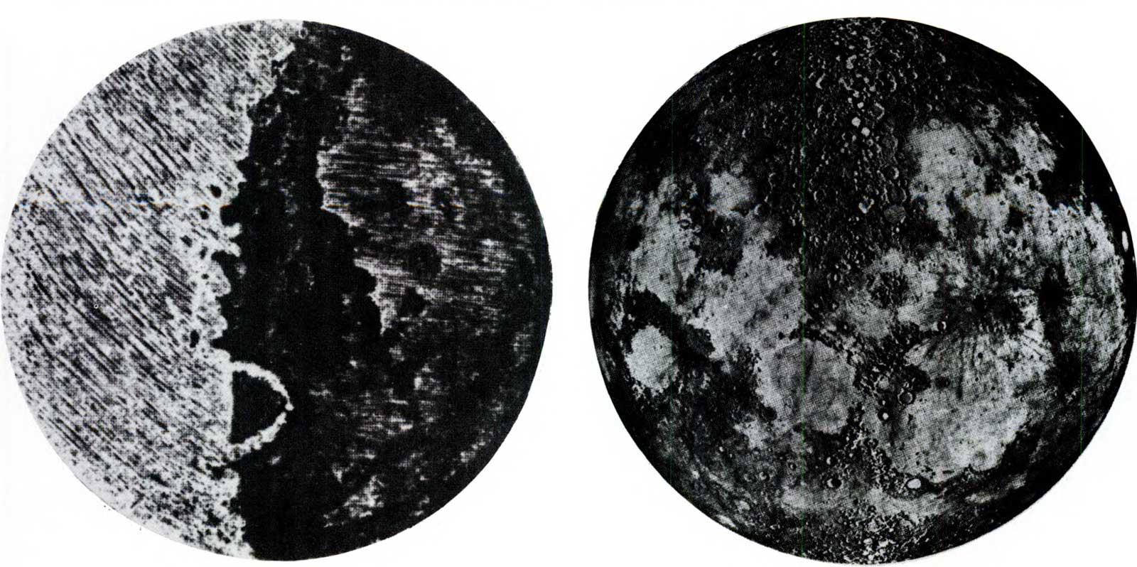
So the question remained: What was the lunar surface really like? While few people really believed the Moon to be made of green cheese, many scientific hypotheses cherished not long ago were equally strange and rather more ominous. They included deep fields of dust into which a spacecraft might sink; a labyrinth of “fairy castles” such as children build by dripping wet sand at the beach; electrostatic dust that might spring up and engulf an alien object; and treacherously covered crevasses into which an unwary astronaut might fall. What proved to be the most accurate prediction, however, likened the Moon to a World War I battlefield, bombarded by a rain of meteoroids throughout the millennia, and churned into a wasteland of craters and debris. The absence of an atmosphere and the low gravitational field would allow small secondary particles to be blasted from the surface by a primary meteoroid impact and thrown unimpeded halfway around the Moon. This led to the concept of a uniform blanket of ejecta over the entire Moon.
But our story is getting ahead of itself. The surface properties of the Moon were largely unknown in 1958, a matter which assumed great practical importance when man’s first journeys to the Moon began to take shape. How much weight would the surface support? What were the slopes? Were there many rocks - and of what size? Would the dust or dirt cling? What was the intensity of primary and secondary meteoroid bombardment? What was the exact size and shape of the Moon, and what were the details of the lunar gravity field into which our spaceships would one day plunge?
A SHAKY START
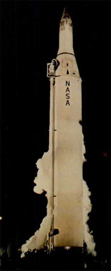
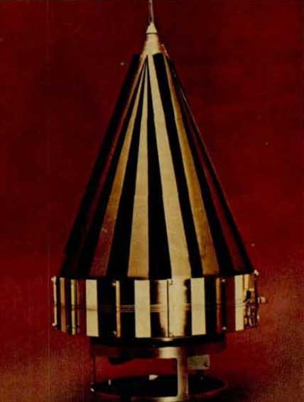
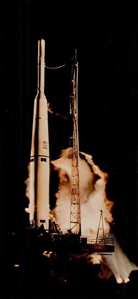
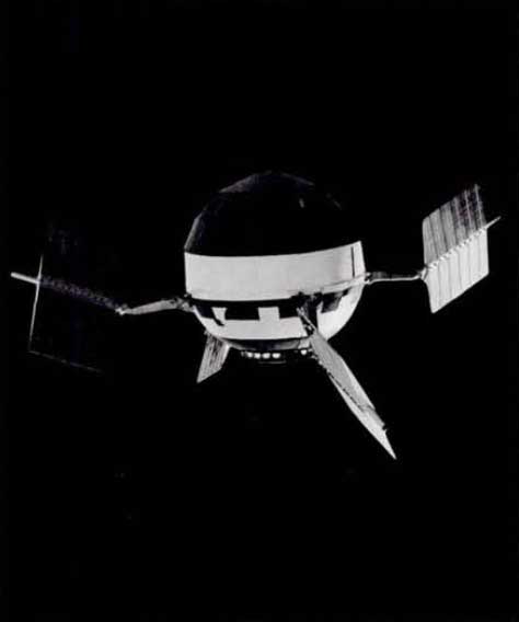
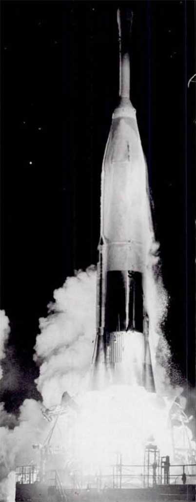
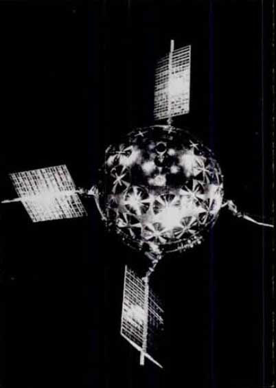
The military rockets developed in the 1950s provided a basic tool with which it became possible to send rudimentary spacecraft to the Moon. Both the Army and the Air Force were quick to initiate efforts to be the first to the Moon with a manmade object. (The Russians, as it proved, were equally quick, or quicker.) These first U.S. projects, which were transferred in 1958 to the newly formed National Aeronautics and Space Administration, consisted of four Air Force Thor-Able rockets, and two Army Juno II rockets, each with tiny payloads, designed to measure radiation and magnetic fields near the Moon and, in some cases, to obtain rudimentary pictures. NASA and the Air Force then added three Atlas-Abie rockets, which could carry heavier payloads, in an attempt to bolster these early high-risk efforts. Of these nine early missions launched between August 1958 and December 1960, none really succeeded. Two Thor-Able and all three Atlas-Able vehicles were destroyed during launch. One Thor-Able and one of the Juno II’s did not attain sufficient velocity to reach the Moon and fell back to Earth. Two rockets were left.
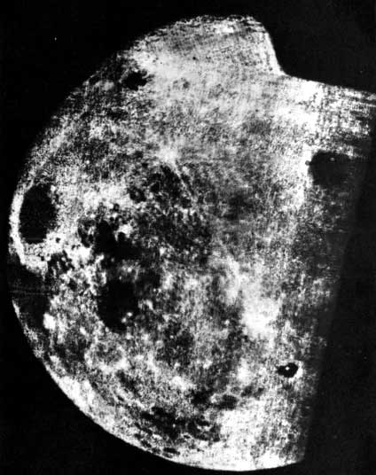
The Soviets were also having problems. But on January 4, 1959, Luna 1, the first space vehicle to reach escape velocity, passed the Moon within about 3700 miles and went into orbit about the Sun. Two months later the United States repeated the feat with the last Juno II, although its miss distance was 37,300 miles. A year later the last Thor-Able payload flew past the Moon, but like its predecessors it yielded no new information about the surface. On October 7, 1959, the Soviet Luna 3 became the first spacecraft to photograph another celestial body, radioing to Earth crude pictures of the previously unseen far side of the Moon. The Moon was not a “billboard in the sky” with slatted back and props. Its far side was found to be cratered, as might be expected, but unlike the front there were no large mare basins. The primitive imagery that Luna 3 returned was the first milepost in automated scientific exploration of other celestial bodies.
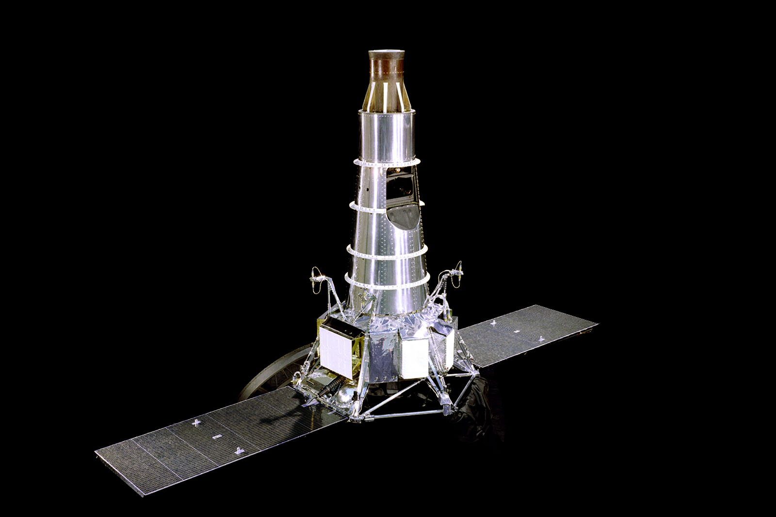
Undaunted by initial failures, and certainly spurred on by Soviet efforts, a NASA team began to plan a long-term program of lunar exploration that would embody all necessary ingredients for success. The National Academy of Sciences was enlisted to help draw the university community into the effort. The Jet Propulsion Laboratory, a California Institute of Technology affiliate that had been transferred from the Army to NASA in 1958, was selected to carry out the program. JPL was already experienced in rocketry and had participated in the Explorer and Pioneer IV projects.
OUR FIRST CLOSE LOOK
The first project to emerge from this government/university team was named Ranger, to connote the exploration of new frontiers. Subsequently Surveyor and Prospector echoed this naming theme. (Planetary missions adopted nautical names such as Mariner, Voyager, and Viking.) The guideline instructions furnished JPL for Ranger read in part: “The lunar reconnaissance mission has been selected with the major objective . . . being the collection of data for use in an integrated lunar-exploration program. . . . The [photographic] system should have an overall resolution of sufficient capability for it to be possible to detect lunar details whose characteristic dimension is as little as 10 feet.” Achieving this goal did not come about easily.
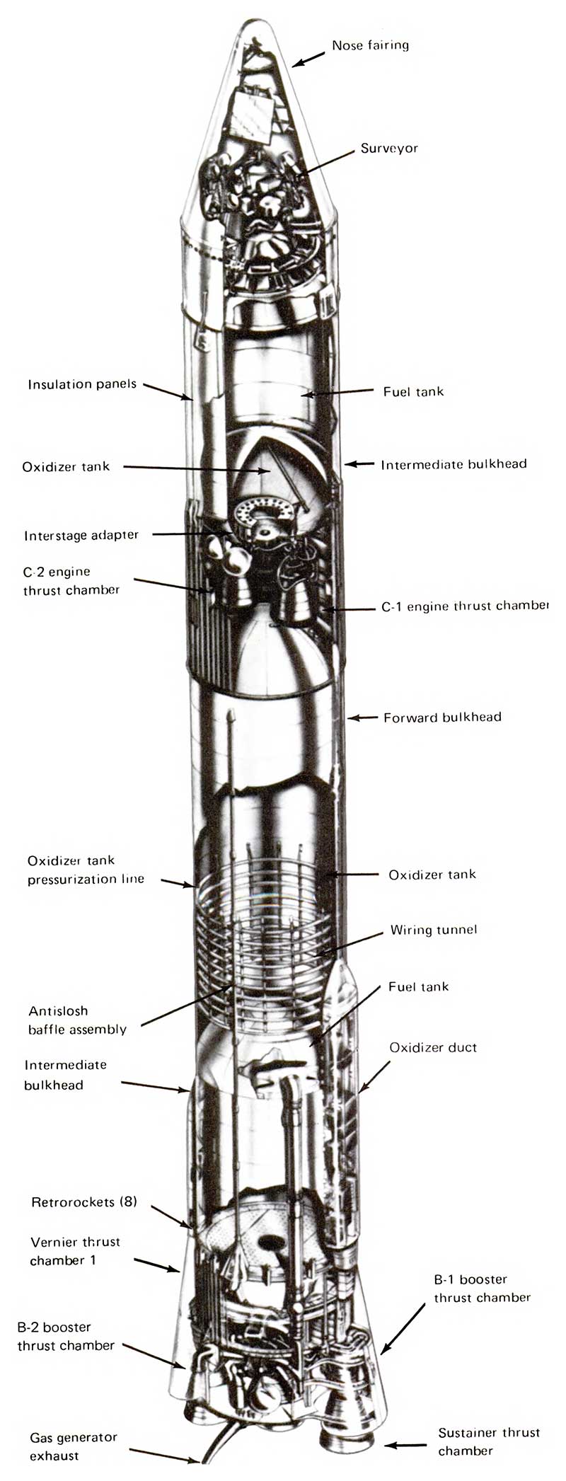
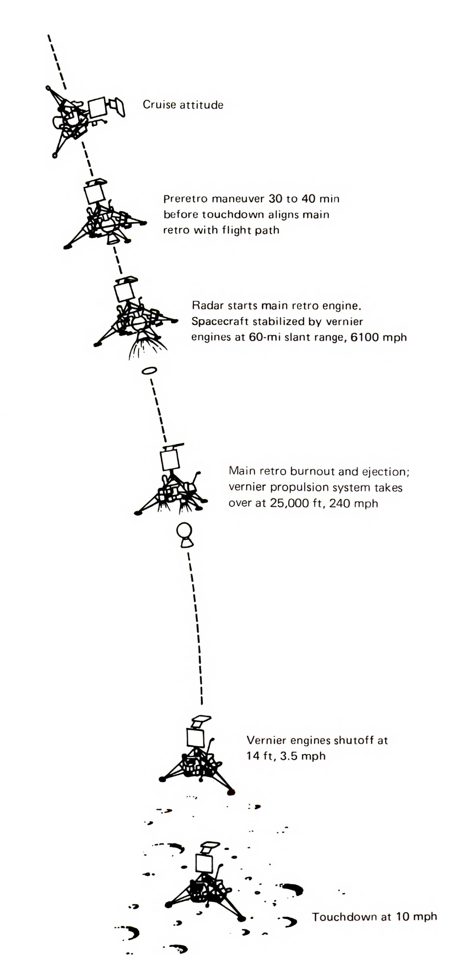
The initial choice of launch vehicle for the Ranger was the USAF Atlas, mated with a new upper stage to be developed by JPL, the Vega. Subsequently NASA cancelled the Vega in favor of an equivalent vehicle already under development by the Air Force, the Agena. This left JPL free to concentrate on the Ranger. The spacecraft design that evolved was very ambitious for its day, incorporating solar power, full three-axis stabilization, and advanced communications. Clearly JPL also had its eye on the planets in formulating this design.
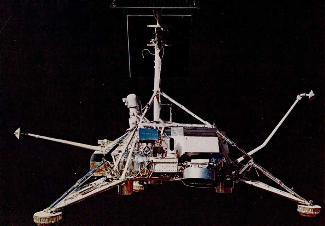
| TYPICAL SURVEYOR SPECIFICATIONS WERE: | |
|---|---|
| WEIGHT | |
| Weight at launch | 2193 lb |
| Landed weight | 625 lb |
| POWER | |
| Solar Panel | 90 watts |
| Batteries | 230 ampere-hours |
| COMMUNICATIONS | |
| Dual transmitters | 10 watts each |
| GUIDANCE AND CONTROL | |
| Inertial reference | 3-axis gyros |
| Celestial reference | Sun and Canopus sensors |
| Attitude control | cold gas jets |
| Terminal landing | automated closed loop, with radar altimeter and doppler velocity sensor |
| PROPULSION | |
| Main retrorocket | 9000-lb solid fuel |
| Vernier retrorockets | throttable between 30- and 102-lb thrust each |
| TV CAMERA | |
| Focal length | 25 or 100 mm |
| Aperture | f/4 to f/22 |
| Resolution | 1 mm at 4 m |
Of a total of nine Rangers launched between 1961 and 1965, only the last three succeeded. From the six failures we learned many lessons the hard way. Early in the program, an attempt was made to protect the Moon from earthly contamination by sterilizing the spacecraft in an oven. This technique, which is now being used on the Mars/Viking spacecraft, had to be abandoned at that time when it wreaked havoc with Ranger’s electronic subsystems.
In the first two launches in 1961 the new Agena B upper stage failed to propel the Ranger out of Earth orbit. Failures in both the launch vehicle and spacecraft misdirected the third flight. On the fourth flight the spacecraft computer and sequencer malfunctioned. And on the fifth flight a failure occurred in the Ranger power system. The U.S. string of lunar missions with little or no success had reached fourteen. Critics were clamoring that Ranger was a “shoot and hope” project. NASA convened a failure review board, and its studies uncovered weaknesses in both the design and testing of Ranger. Redundancy was added to electronic circuits and test procedures were tightened. As payload Ranger VI carried a battery of six television cameras to record surface details during the final moments before impact. When it was launched on January 30, 1964, we had high confidence of success. Everything seemed to work perfectly. But when the spacecraft plunged to the lunar surface, precisely on target, its cameras f ailed to turn on. I will never forget the feeling of dismay in the JPL control room that day.
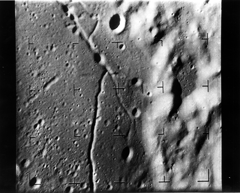
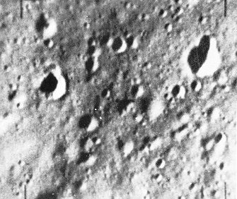
But we all knew we were finally close. Careful detective work with the telemetry records identified the most probable cause as inadvertent turn-on of the TV transmitter while Ranger was still in the Earth’s atmosphere, whereupon arcing destroyed the system. The fix was relatively simple, although it delayed the program for three months. On July 28, 1964, Ranger VII was launched on what proved to be a perfect mission. Eighteen minutes before impact in Oceanus Procellarum, or Ocean of Storms, the cameras began transmitting the first of 4316 excellent pictures of the surface. The final frame was taken only 1400 feet above the surface and revealed details down to about 3 feet in size. It was a breathless group of men that waited the arrival of the first quick prints in the office of Bill Pickering, JPL’s Director. The prints had not been enhanced and it was hard to see the detail because of lack of contrast. But those muddy little pictures with their ubiquitous craters seemed breathtakingly beautiful to us.
By the time of the Ranger VII launch, the Apollo program had already been underway for three years, and Ranger had been configured and targeted to scout possible landing sites. Thus Ranger VIII was flown to a flat area in the Sea of Tranquility where it found terrain similar to that in the Ocean of Storms: gently sloping plains but craters everywhere. It began to look as if the early Apollo requirement of a relatively large craterless area would be difficult to find. As far as surface properties were concerned, the Ranger could contribute little to the scientific controversy raging over whether the Moon would support the weight of a machine - or a man.
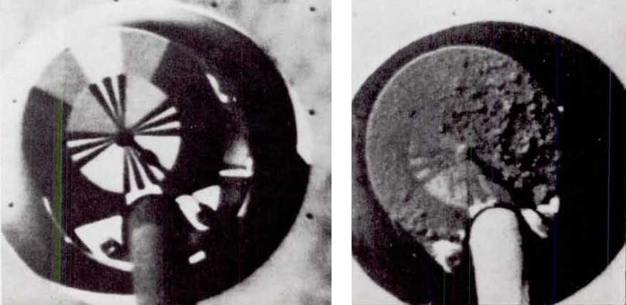
To get maximum resolution of surface details, it was necessary to rotate Ranger so that the cameras looked precisely along the flight path. This was not done on Ranger VII in order to avoid the risk of sending extra commands to the attitude-control system. I recall that on Ranger VIII JPL requested permission to make the final maneuver. NASA denied permission - we were still unwilling, after the long string of failures, to take the slightest additional risk. It was not until Ranger IX that JPL made the maneuver and achieved resolution approaching 1 foot in the last frame. This final Ranger, launched on March 21, 1965, was dedicated to lunar science rather than to reconnaissance of Apollo landing sites. It returned 5814 photographs of the crater Alphonsus, again showing craters within craters, and some rocks. Despite its dismal beginnings the Ranger program was thus concluded on a note of success. Proposed follow-on missions were cancelled in favor of upcoming Surveyor and Orbiter missions, whose development had been proceeding concurrently.
TESTING THE SURFACE
Surveyor, which had been formally approved in the spring of 1960, was originally conceived for the scientific investigation of the Moon’s surface. As in the case of the Ranger, its use was redirected according to the needs of Apollo.
With the proposed addition of an orbiting version of Surveyor, later to become Lunar Orbiter, the unmanned lunar-exploration program in support of Apollo shaped up this way: Ranger would provide us with our first look at the surface, Surveyor would make spot checks of the mechanical properties of the surface; and Lunar Orbiter would supply data for mapping and landing-site selection. The approach was sound enough, but carrying it out led us into a jungle of development difficulties.
Few space projects short of Apollo itself embodied the technological audacity of Surveyor. Its Atlas-based launch vehicle was to make use of an entirely new upper stage, the Centaur, the world’s first hydrogen-fueled rocket. It had been begun by the Department of Defense and later transferred to NASA. Surveyor itself was planned to land gently on the lunar surface, set down softly by throttable retrorockets under control of its own radar system. It was to carry 350 pounds of complex scientific instruments. Responsibility for continuing the Centaur development was placed with the Marshall Space Flight Center, with General Dynamics the prime contractor. JPL took on the task of developing the Surveyor, and the Hughes Aircraft Company won the competition for building it. We soon found that it was a very rough road. Surveyor encountered a host of technical problems that caused severe schedule slips, cost growth, and weight growth. The Centaur fared little better. Its first test flight in 1962 was a failure. Its lunar payload dropped from the planned 2500 pounds to an estimated 1800 pounds or less - not sufficient for Surveyor. Its complex multistart capability was in trouble. Wernher von Braun, necessarily preoccupied with the development of Saturn, recommended cancelling Centaur and using a Saturn-Agena combination for Surveyor.
At this point we regrouped. Major organizational changes were made at JPL and Hughes to improve the development and testing phases of Surveyor. NASA management of Centaur was transferred to the Lewis Research Center under the leadership of Abe Silverstein, where it would no loncer have to compete with Saturn for the attention it needed to succeed. Its initial capabilities were targeted to the minimum required for a Surveyor mission - 2150 pounds on a lunar-intercept trajectory. This reduced weight complicated work on an already overweight Surveyor, and the scientific payload dropped to about 100 pounds.
It all came to trial on May 31, 1966, when Surveyor I was launched atop an Atlas-Centaur for the first U.S. attempt at a soft landing. On June 2, Surveyor I touched down with gentle perfection on a level plain in the Ocean of Storms, Oceanus Procellarum. A large covey of VIPs had gathered at the JPL control center to witness the event. One of them, Congressman Joseph E. Karth, whose Space Science and Applications Subcommittee watched over both Surveyor and Centaur, had been both a strong supporter and, at times, a tough critic of the program. The odds for success on this complex and audacious first mission were not high. I can still see his broad grin at the moment of touchdown, a grin which practically lighted up his corner of the darkened room. We sat up most of the night watching the first of the 11,240 pictures that Surveyor I was to transmit.
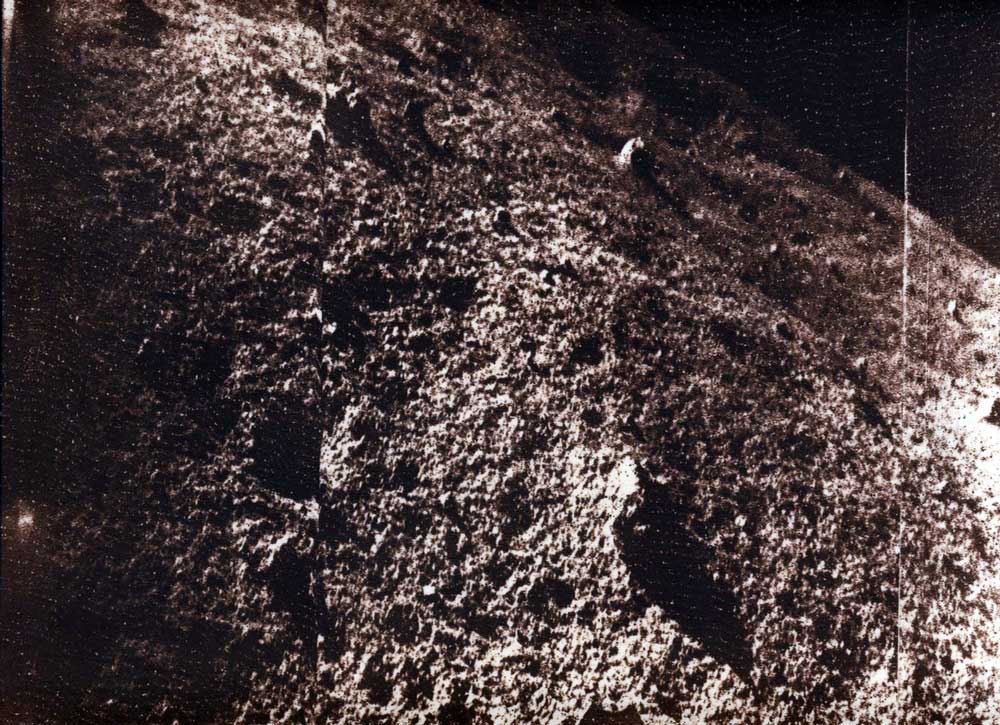
Four months prior to Surveyor’s landing, on February 3, 1966, the Russian Luna 9 landed about 60 miles northeast of the crater Calaverius, and radioed back to Earth the first lunar-surface pictures. This was an eventful year in lunar exploration, for only two months after Surveyor I, the U.S. Lunar Orbiter I usbered in that successful and richly productive series of missions.
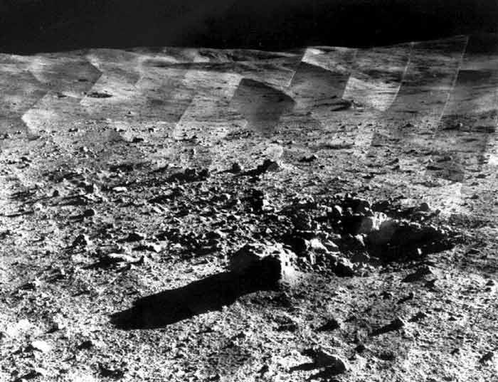
Surveyor found, as had Luna before it, a barren plain pitted with countless craters and strewn with rocks of all sizes and shapes. No deep layer of soft dust was found, and analysts estimatcd that the surface appeared to be firm enough for both spacecraft and men. The Surveyor camera, which was more advanced than Luna’s, showed very fine detail. The first frame transmitted to Earth showed a footpad and its impression on the lunar surface, which we had preprogrammed just in case that was the only picture that could be received. At our first close glimpse of the disturbed lunar surface, the material seemed to behave like moist soil or wet sand, which, of course, it was not. Its appearance was due to the cohesive nature of small particles in a vacuum.
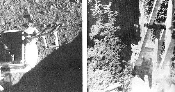
Surveyor II tumbled during a midcourse maneuver and was lost, but on April 19, 1967, Surveyor III made a bumpy landing inside a 650-foot crater in the eastern part of the Sea of Clouds. Its landing rockets had failed to cut off and it skittered down the inner slope of a crater before coming to rest. Unlike its predecessors, Surveyor III carried a remotely controlled device that could dig the surface. During the course of digging, experimenters dropped a shovelful of lunar material on a footpad to examine it more closely. When Surveyor III was visited by the Apollo 12 astronauts 30 months later in 1970, the little pile was totally undisturbed, as can be seen in the photograph reproduced at the beginning of Chapter 12.
The historic rendezvous of Apollo 12 with Surveyor III would never have been possible without the patient detective work of Ewen Whitaker of the University of Arizona. The difficulty was that the landing site of Surveyor was not precisely known. Using Surveyor pictures of the inside of the crater in which it had landed, Whitaker compared surface details with details visible in Orbiter photographs of the general area that had been taken before the Surveyor landing. He eventually found a 650-foot crater that matched, and concluded that that was where Surveyor must be. Thus the uncertainty in Surveyor’s location was reduced from several miles down to a single crater. By using Orbiter photographs as a guide, Apollo 12 was able to fly down a “cratered trail” to a landing only 600 feet away from Surveyor.
Surveyor IV failed just minutes before touchdown, but the last three Surveyors were successful. On September 10, 1967, Surveyor V landed on the steep inner slopes of a 30 by 40 foot crater on Mare Tranquillitatis. It carried a new instrument, an alpha-backscattering device developed by Anthony Turkevich of the University of Chicago. With this device he was able to make a fairly precise analysis of the chemical composition of the lunar-surface material, which he correctly identified as resembling terrestrial basalts. This conclusion was also supported by the manner in which lunar material adhered to several carefully calibrated magnets on Surveyor. Two days after landing, Surveyor V’s engines were reignited briefly to see what effect they would have on the lunar surface. The small amounts of erosion indicated that this would pose no real problem for Apollo, though perhaps causing some loss of visibility just before touchdown.
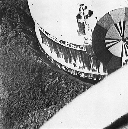
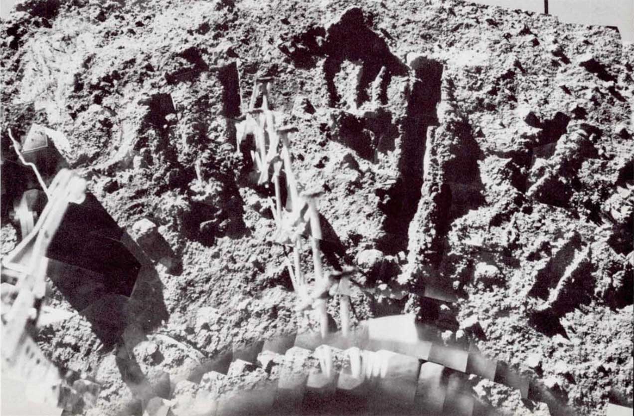
Surveyor VI checked out still another possible Apollo site in Sinus Medii. The rocket-effects experiment was repeated and this time the Surveyor was “flown” to a new location approximately 8 feet from the original landing point. Some of the soil thrown out by the rockets stuck to the photographic target on the antenna boom, as shown here.
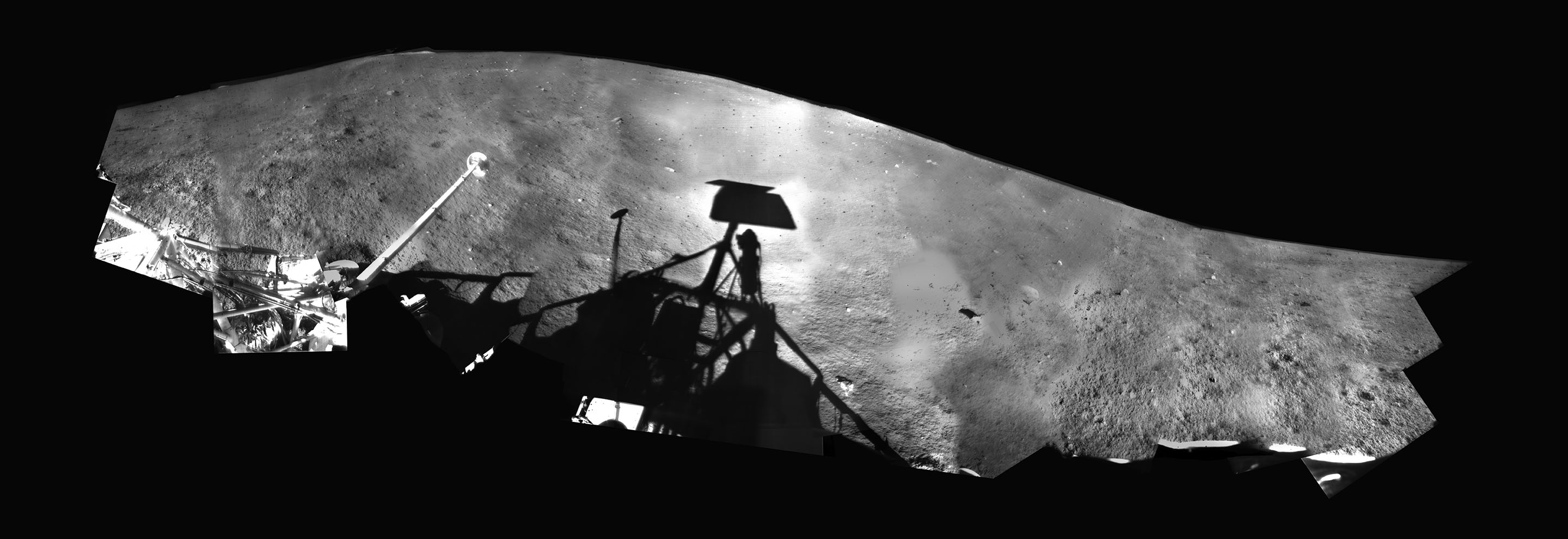
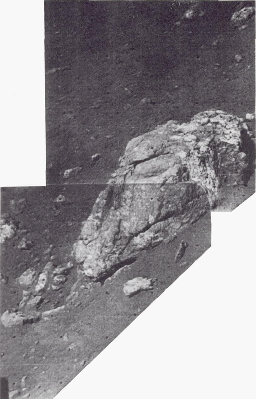
The last Surveyor was landed in a hiiyhland area just north of the crater Tycho on January 9, 1968. A panoramic picture of this ejecta field taken by Surveyor VII is shown here as well as a mosaic of its surface “gardening” area. I remember walking into the control room at JPL at the moment the experimenters were attempting to free the backscatter instrument, which had hung up during deployment. Commands were sent to the surface sampler to press down on it. The delicate operation was being monitored and guided with Surveyor’s television camera. When I started asking questions, Dr. Ron Scott of Cal Tech crisply reminded me that at the moment they were “quite busy”. I held my questions - and they got the stuck instrument down to the surface. It seemed almost unreal to be remotely repairing a spacecraft on the Moon some quarter of a million miles away.
Before the launch of Surveyor I, in the period when we faced cost overruns and deep technical concerns, NASA and JPL had pressed the Hughes Aircraft Company to accept a contract modification that would give up some profit already earned in favor of increased fee opportunities in the event of mission successes. They accepted, and this courageous decision paid off for both parties. NASA of course was delighted with five out of seven Surveyor successes.
MAPPING AND SITE SELECTION
Meanwhile the third member of the automated lunar exploration team had already completed its work. The fifth and last Lunar Orbiter had been launched on August 1, 1967, nearly half a year earlier. When JPL and Hughes began to experience difficulties with Surveyor development, and with the Centaur in deep trouble, NASA decided to back up the entire proaram with a different team and different hardware. The Surveyor Orbiter concept was scrapped, and NASA’s Langley Research Center was directed to plan and carry out a new Lunar Orbiter program, based on the less risky Atlas-Acena D launch vehicle. Langley prepared the necessary specifications and Boeing won the job. Boeing’s proposed design was beautifully straightforward except for one feature, the camera. Instead of being all-electronic as were prior space cameras, the Eastman Kodak camera for the Lunar Orbiter made use of 70-mm film developed on board the spacecraft and then optically scanned and telemetered to Earth. Low-speed film had to be used so as not to be fogged by space radiation. This in turn required the formidable added complexity of image-motion compensation during the instant of exposure. Theoretically, objects as small as three feet could be seen from 30 nautical miles above the surface. If all worked well, this system could provide the quality required for Apollo, but it was tricky, and it barely made it to the launch pad in time to avoid rescheduling.
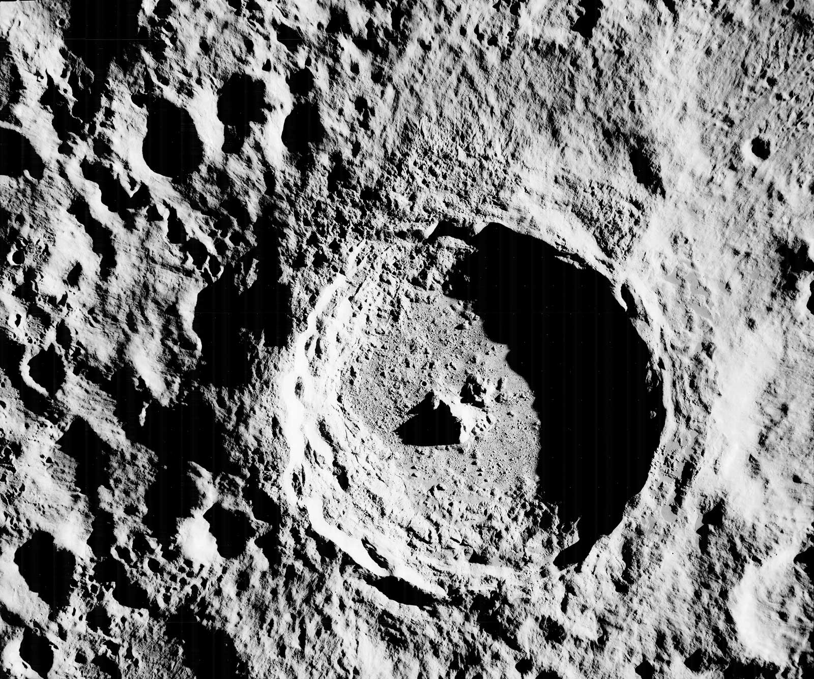
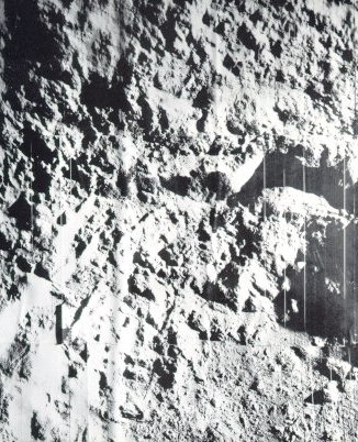
The Orbiter missions were designed to photograph all possible Apollo landing sites, to measure meteoroid flux around the Moon, and to determine the lunar gravity field precisely, from accurate tracking of the spacecraft. Orbiter did all these things - and more. As the primary objectives for Apollo program were essentially accomplished on completion of the third mission, the fourth and fifth missions were devoted largely to broader, scientific objectives - photography of the entire lunar nearside during Mission IV and photography of 36 areas of particular scientific interest on the near side during Mission V. In addition, 99 percent of the far side was photographed in more detail than Earth-based telescopes had previously photographed the front.
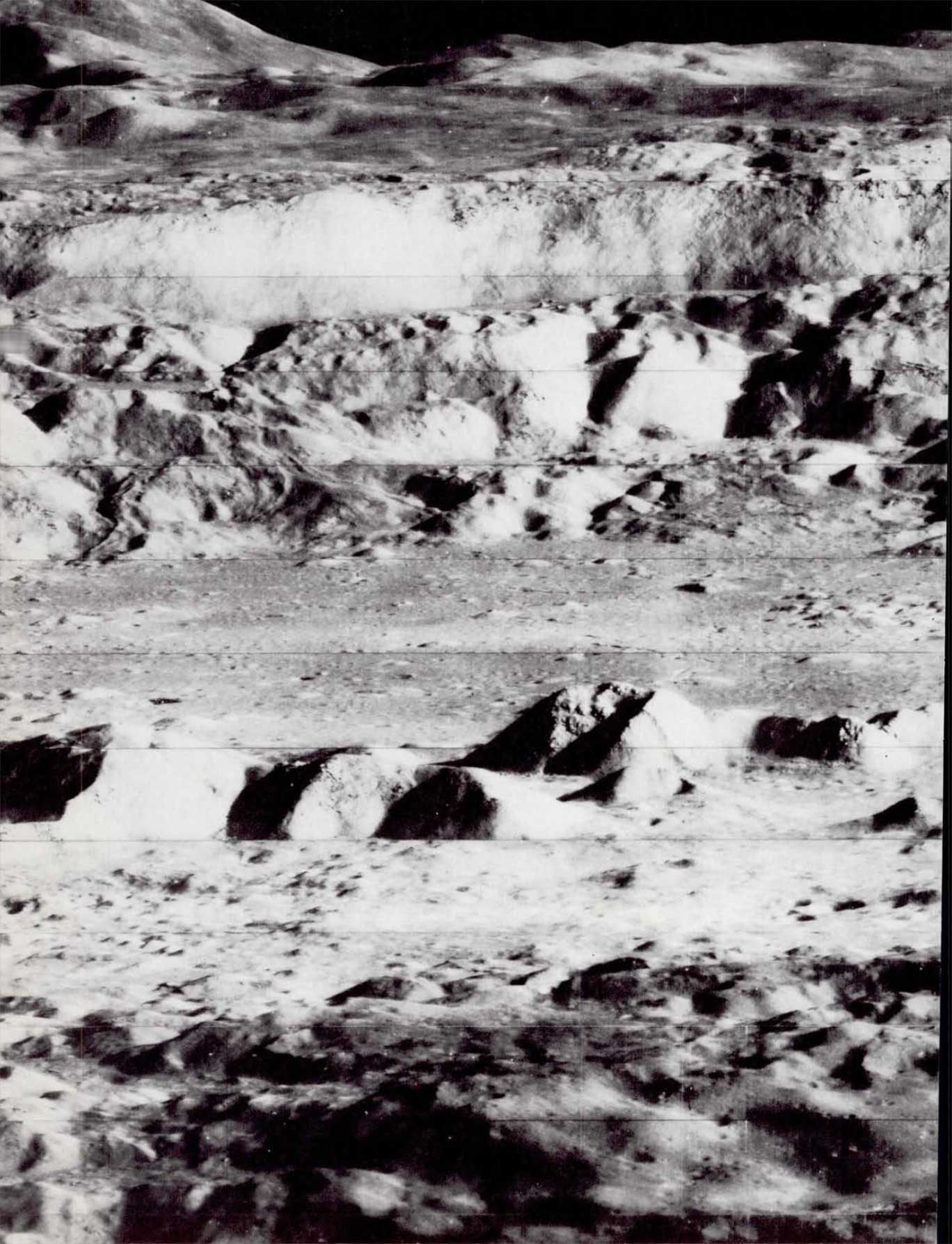
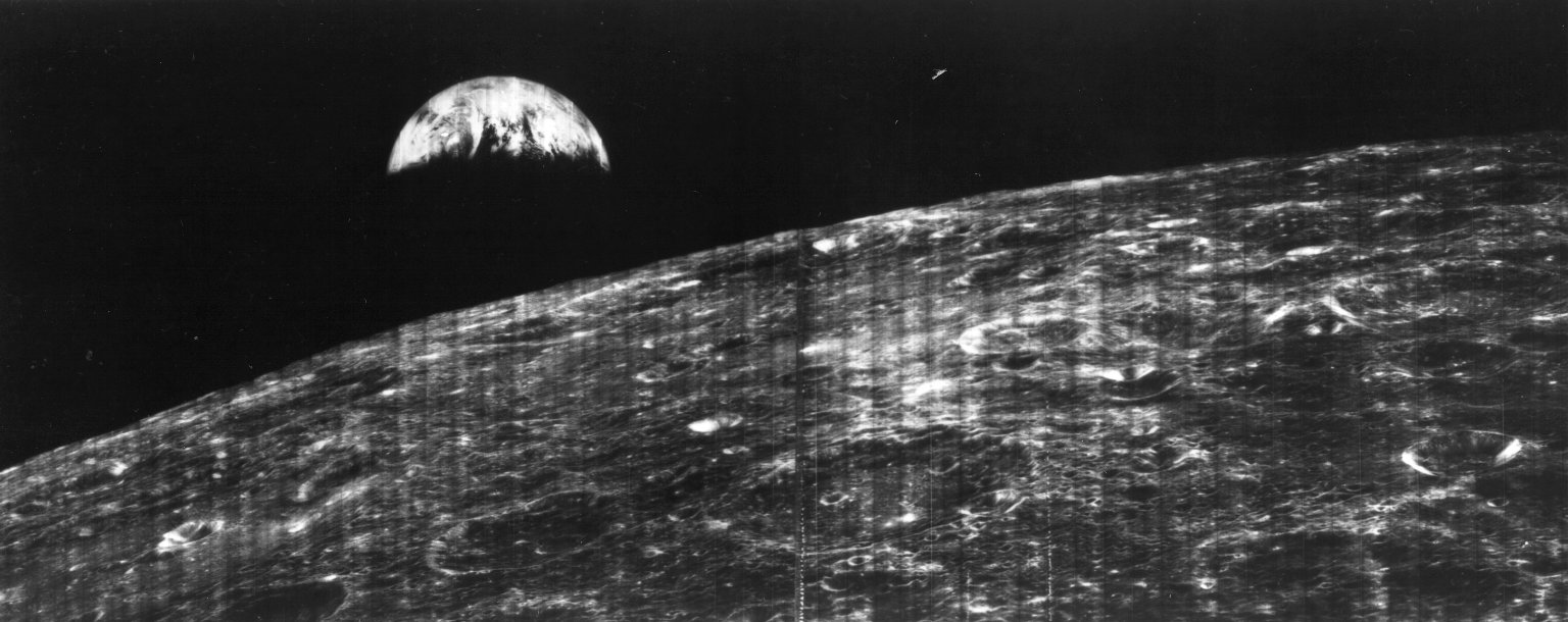
The first Lunar Orbiter spacecraft was launched on August 10, 1966, and photographed nine primary and seven secondary sites that were candidates for Apollo landings. The medium-resolution pictures were of good quality, but a malfunction in the synchronization of the shutter caused loss of the high-resolution frames. In addition, some views of the far side and oblique views of the Earth and Moon were also taken (see here). When we made the suggestion of taking this “Earthrise” picture, Boeing’s project manager, Bob Helberg, reminded NASA that the spacecraft maneuver required constituted a risk that could jeopardize the company profit, which was tied to mission success. He then made the gutsy decision to go ahead anyway and we got this historic photograph.
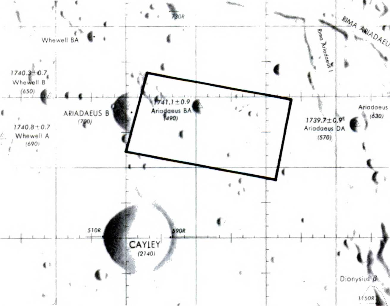
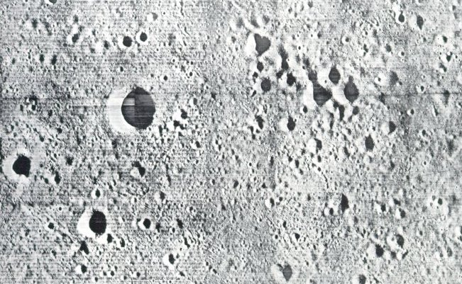
The next two Lunar Orbiter missions were launched on November 6, 1966, and February 4, 1967. They provided excellent coverage of all 20 potential Apollo landing sites, additional coverage of the far side and other lunar features of scientific interest, and many oblique views of lunar terrain as it might be seen by an orbiting astronaut. One of these was a dramatic oblique photograph of the crater Copernicus, which NASA’s Associate Administrator, Dr. Robert C. Seamans, unveiled at a professional society conference in Boston and which drew a standing ovation and designation as “picture of the year”. Among the possible Apollo sites photographed by Orbiter III was the landing site of Surveyor I. Careful photographic detective work found the shining Surveyor and its dark shadow among the myriad craters.
The Apollo site surveys yielded surprises. Some sites that had looked promising in Earth-based photography were totally unacceptable. No sites were found to be as free of craters as had been originally specified for Apollo, so the Langley lunar landing facility was modified to give astronauts practice at crater dodging. Since the basic Apollo photographic requirements were essentially satisfied by the first three flights, the last two Orbiters launched on May 4 and August 1, 1967, were placed in high near-polar orbits from which they completed coverage of virtually the entire lunar surface.
The other Orbiter experiments were also productive. No unexpected levels of radiation or meteoroids were found to offer a threat to astronaut safety. Studies of the Orbiter motion, however, revealed relatively large gravitational variations due to buried mass concentrations - the phrase was soon telescoped to “mascons” - in the Moon’s interior. This alerted Apollo planners to account properly for mascon perturbations when calculating precise Apollo trajectories.
With the completion of the Ranger, Surveyor, and Orbiter programs, the job of automated spacecraft in scouting the way for Apollo was done. Our confidence was high that few unpleasant surprises would wait our Apollo astronauts on the lunar surface. The standard now passed from automated machinery to hands of flesh and blood.